Nuremberg Tourist Map: Old Town, Castle and Walking Route
We are Ana and Kevin, and Nuremberg is one of the easiest German cities to understand once the map is split between the castle hill, the Old Town, the river, the city walls and practical transport points. This Nuremberg tourist map helps you plan a walking route without turning the day into a back-and-forth zigzag.
Disclosure: this article contains affiliate links. We may earn a commission if you book accommodation, activities, insurance or flights through them, at no extra cost to you.
If you are searching for a tourist map of Nuremberg, Nuremberg old town map, Nuremberg walking map or Nuremberg tourist map PDF, start with the slope. The castle sits above the old town, Hauptmarkt is the central midpoint, and the walls help you read the loop. For a wider route, compare this page with our Germany tourist map, Bavaria tourist map, Munich tourist map, Romantic Route tourist map and Quedlinburg tourist map.
Interactive Tourist Map of Nuremberg
Use the map to group Imperial Castle, Hauptmarkt, churches, the river, city walls, museums, U-Bahn points and stay areas. Nuremberg is compact, but route order matters because the castle side is higher.
Load the Nuremberg map to plan the Old Town, Imperial Castle, city walls, Hauptmarkt, museums, U-Bahn and stay areas.
Open the Nuremberg tourist map in Google MapsBest Areas to Read on the Nuremberg Map
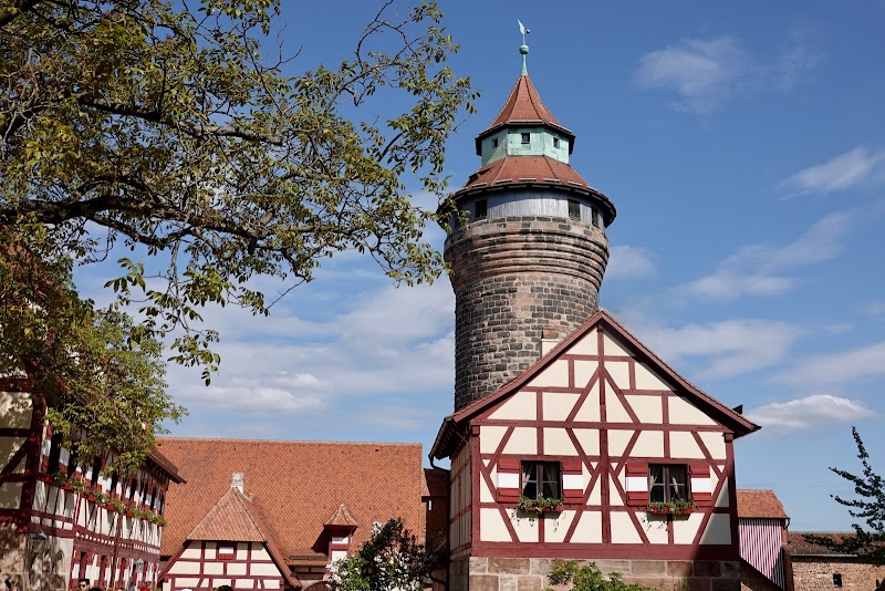
Imperial Castle and castle hill
The Imperial Castle is the strongest first anchor. We would either start there and walk downhill into the Old Town, or save it for a clear castle-focused block. Trying to visit it as a random detour can break the route.

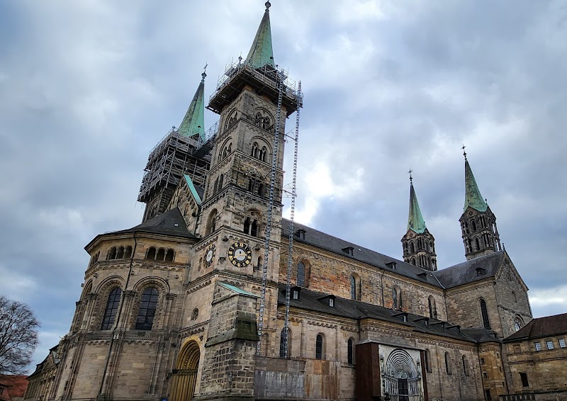
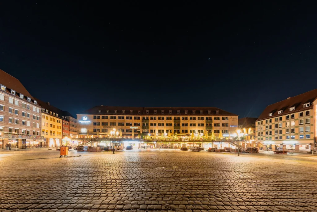
Hauptmarkt, Frauenkirche and the central old town
Hauptmarkt is the midpoint of many Nuremberg walks. It connects the Frauenkirche, market square, nearby churches, food stops and the streets that lead toward the river. During Christmas Market season, this area needs extra time and patience.
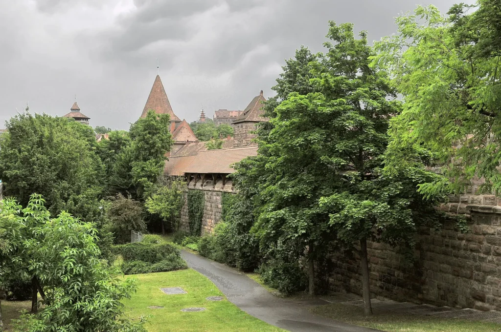
City walls, gates and river crossings
The walls and gates make the old town shape much easier to understand. Add them as part of a loop with the river instead of treating them as isolated photo stops.
Museums, U-Bahn and wider Nuremberg
If you add museums or sites outside the old town, use the U-Bahn layer. Nuremberg is walkable in the centre, but transport matters when the route stretches beyond the old town wall.
Suggested Nuremberg Walking Routes from the Map
Classic half day: Imperial Castle, castle viewpoints, Hauptmarkt, Frauenkirche, river streets and a short wall section.
Old Town full day: castle hill, Albrecht Durer area, Hauptmarkt, churches, river crossings, city walls and museum time.
Christmas Market route: Hauptmarkt first, then castle or river sections before returning for evening lights.
Bavaria route connection: use Nuremberg as a northern Bavaria base before Munich, Bamberg, Rothenburg or the Romantic Route.
Where to Stay in Nuremberg for Easy Map Routes
For a first visit, compare Old Town, Hauptmarkt area, near the main station and castle-side streets. Old Town is best for walking, the station helps with day trips, and the castle side is atmospheric but hillier.
Find accommodation in Nuremberg
Plan activities, insurance and flights for Nuremberg
Once the map route is clear, the next practical step is checking what to book around it: guided activities, travel insurance and flight options if you are coming from abroad.
Use the activity widget below to compare current tours and tickets for Nuremberg. For the travel side, you can also review insurance with IATI and compare flights before fixing dates.
Check travel insurance with IATI Compare flights for Nuremberg
Nuremberg Map Planning Checklist
Best first anchor: Imperial Castle or Hauptmarkt, depending on whether you want to start high or central.
Best route rule: walk downhill from castle hill when possible.
Best season note: Christmas Market changes walking pace around Hauptmarkt.
Best mistake to avoid: ignoring the wall and river shape; they make the old town route much easier to read.
Frequently Asked Questions about the Nuremberg Tourist Map
What should be on a Nuremberg tourist map?
A useful Nuremberg tourist map should include Imperial Castle, Hauptmarkt, Frauenkirche, the city walls, river crossings, museums, main station, U-Bahn stops and stay areas.
Is Nuremberg easy to visit on foot?
Yes. The Old Town is very walkable, though the castle side is uphill. Use U-Bahn or trams when you add sites outside the historic centre.
Where should you stay in Nuremberg?
Old Town is best for sightseeing, the main station is practical for rail trips, and the castle side works if you want atmosphere and do not mind hills.
How long do you need in Nuremberg?
One full day covers the Old Town and castle well. Two days are better if you want museums, slower food stops or day trips around Bavaria.