Oxford Tourist Map: Colleges, Radcliffe Camera and Walking Route
We are Ana and Kevin, and Oxford is much easier to enjoy when the map is read as a compact walking route instead of a long list of college names. Radcliffe Camera, the Bridge of Sighs, Bodleian Library, Christ Church, museums, covered market streets and the station all sit close enough to connect on foot, but route order matters. This Oxford tourist map helps you plan the city centre, college quarter and riverside edges without wasting time crossing the same lanes again and again.
Disclosure: this article contains affiliate links. We may earn a commission if you book accommodation through them, at no extra cost to you.
If you are searching for a tourist map of Oxford, Oxford city centre map, Oxford walking map or Oxford attractions map, start with the historic centre. The useful route is not only about famous colleges; it is about linking colleges, libraries, museums, markets, green spaces and arrival points. For a wider UK plan, compare this page with our England tourist map, Cambridge tourist map, London tourist map and York tourist map.
Interactive Tourist Map of Oxford
Use the map to group Radcliffe Camera, the Bridge of Sighs, Christ Church, central colleges, museums, the Covered Market, riverside walks, station access and stay areas. Oxford is walkable, but it rewards a route that keeps the historic core tight.
Load the Oxford map to group Radcliffe Camera, the Bridge of Sighs, colleges, museums, riverside walks, station access and stay areas.
Open the Oxford tourist map in Google MapsBest Areas to Read on the Oxford Map
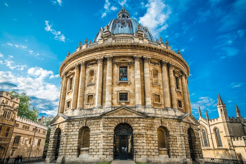
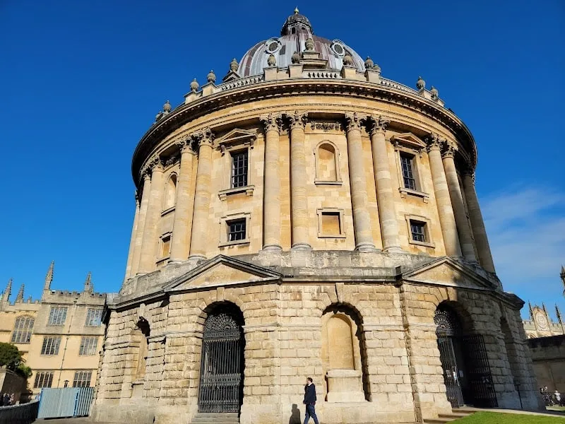
Radcliffe Camera, Bodleian Library and central colleges
Radcliffe Camera is the clearest central anchor. We would use it as the point that connects the Bodleian Library, nearby colleges, Broad Street and the lanes that lead toward the market. This is the part of Oxford where a map helps most because many major sights sit close together.
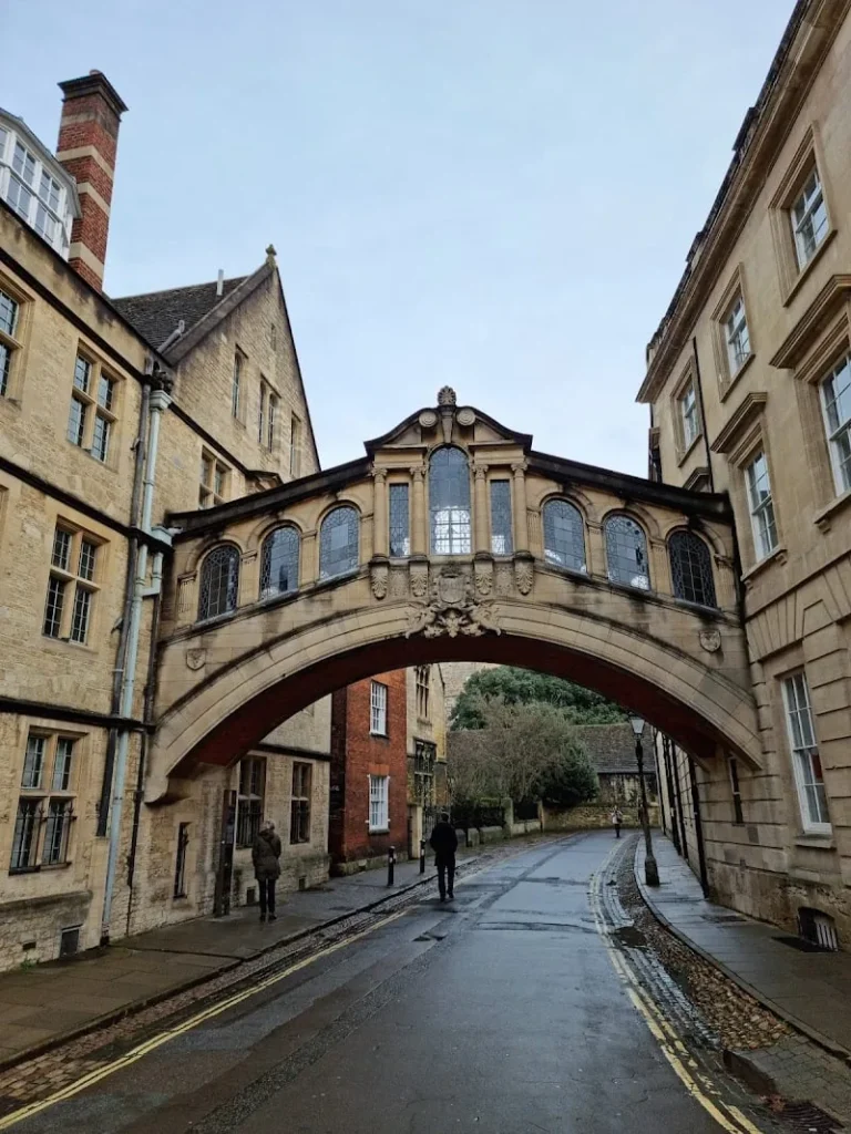
Bridge of Sighs and Broad Street
The Bridge of Sighs works well as a short landmark stop between the college quarter and Broad Street. It is not a long visit by itself, but it makes sense when folded into a loop with Radcliffe Camera and the surrounding university buildings.
Christ Church, meadows and the southern route
Christ Church gives the Oxford map a second strong section. If you add it, leave enough time for the walk south and for the meadows or river edge, rather than treating it as a quick detour from the central lanes.

Museums, market streets and station access
The Ashmolean side, Covered Market, High Street and station route are practical layers. They are useful when weather changes, when you arrive by train, or when you want food stops without breaking the sightseeing route.
Suggested Oxford Walking Routes from the Map
Classic half day: station or bus arrival, Broad Street, Bridge of Sighs, Radcliffe Camera, Bodleian area, Covered Market and one college exterior.
Full city day: Radcliffe Camera, central colleges, Christ Church, meadows or river edge, Ashmolean Museum and a slower food stop around the market.
College-focused route: keep the walk tight around Radcliffe Square, Broad Street and Christ Church instead of trying to add every college name on the map.
Rain-friendly route: prioritize covered market streets, museums, libraries or indoor college visits, then add exterior landmarks when the weather clears.
Where to Stay in Oxford for Easy Map Routes
For a first visit, compare Oxford city centre, near the railway station, Jericho and St Clement's/Cowley Road. City centre is best for walking, the station side is practical for rail arrivals, Jericho feels calmer, and Cowley Road works better if food and nightlife matter more than being beside every landmark.
Oxford Map Planning Checklist
Best first anchor: Radcliffe Camera and the Bodleian area.
Best route shape: a tight college-centre loop, then one southern or museum extension.
Best transport note: most first-visit routes work on foot from the station or bus stops.
Best mistake to avoid: adding too many college names without checking which interiors are open and how far the detours are.
Frequently Asked Questions about the Oxford Tourist Map
What should be on an Oxford tourist map?
A useful Oxford tourist map should include Radcliffe Camera, Bodleian Library, Bridge of Sighs, Christ Church, Broad Street, Covered Market, Ashmolean Museum, riverside walks, the station and central stay areas.
Is Oxford easy to visit on foot?
Yes. The central sights are very walkable. A map is still helpful because narrow streets, college entrances and opening times can make the route feel less obvious than the distances suggest.
How long do you need in Oxford?
A half day covers a compact centre loop. One full day is better if you want Christ Church, museums, meadows, food stops and time to slow down around the college quarter.
Where should you stay in Oxford?
City centre is best for sightseeing, the station area is practical for rail, Jericho is calmer, and Cowley Road works well for food and nightlife if you do not mind a longer walk.