
Cambridge Tourist Map: Colleges, River Cam and Walking Route
We are Ana and Kevin, and Cambridge is one of those cities where the map should feel compact but intentional. King's College, Market Square, the River Cam, The Backs, Fitzwilliam Museum, the station route, cycle streets and quieter college lanes sit close together, yet route order still matters. This Cambridge tourist map helps you plan the city as a walkable set of zones, not as a list of isolated pins.
Disclosure: this article contains affiliate links. We may earn a commission if you book accommodation, activities, insurance or flights through them, at no extra cost to you.
If you are searching for a tourist map of Cambridge, Cambridge city centre map, Cambridge walking map or Cambridge attractions map, start with the historic centre and then decide whether the River Cam, museums, gardens or station side deserve more time. For a wider UK route, compare this page with our England tourist map, Oxford tourist map, London tourist map and York tourist map.
Interactive Tourist Map of Cambridge
Use the map to group King's College, Senate House, Market Square, The Backs, River Cam, Fitzwilliam Museum, the Botanic Garden, railway station access, cycling areas and practical stay zones. Cambridge is easy to walk, but a good route saves time between colleges, museums and the river.
Load the Cambridge map to group King's College, Market Square, The Backs, River Cam, museums, station access, cycling streets and stay areas.
Open the Cambridge tourist map in Google MapsBest Areas to Read on the Cambridge Map
King's College, Senate House and Market Square
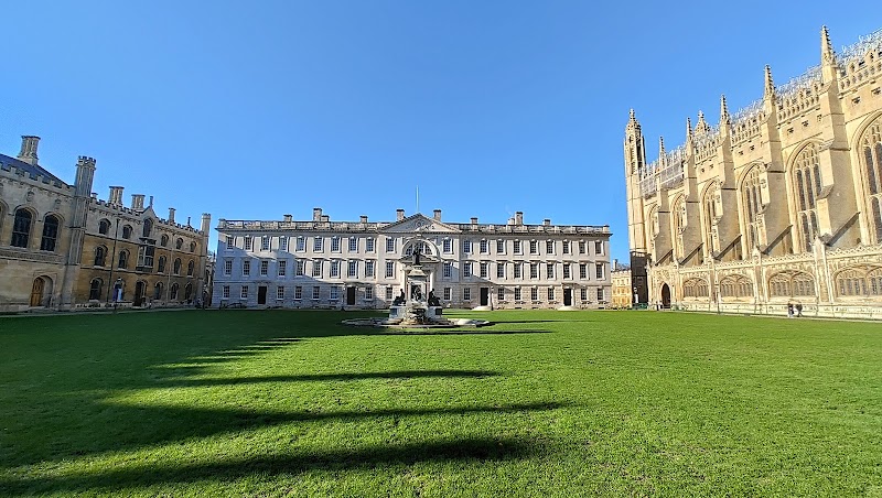
King's College Chapel is the cleanest central anchor. We would read the map from here first, then add Senate House, Trinity Street, Great St Mary's, Market Square and nearby college entrances. This keeps the historic core tight and gives you a clear route before adding river or museum detours.
River Cam, The Backs and punting routes
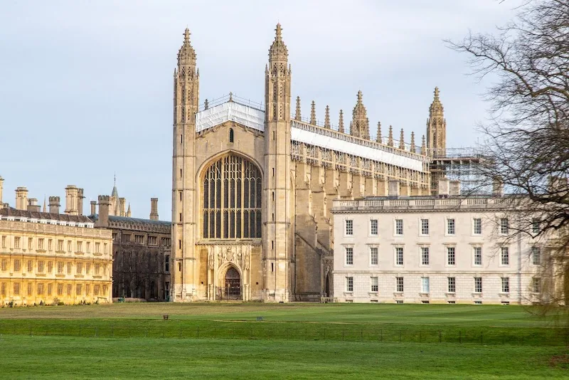
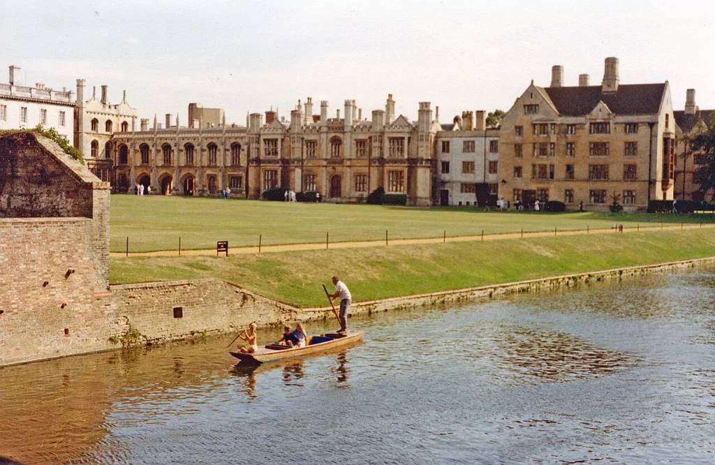
The River Cam changes the rhythm of the visit. If punting or riverside views matter, mark The Backs early instead of leaving them for the end of the day. The river section is close to the colleges, but it is slower, more scenic and often busier than the distances suggest.
Fitzwilliam Museum, Trumpington Street and the southern edge
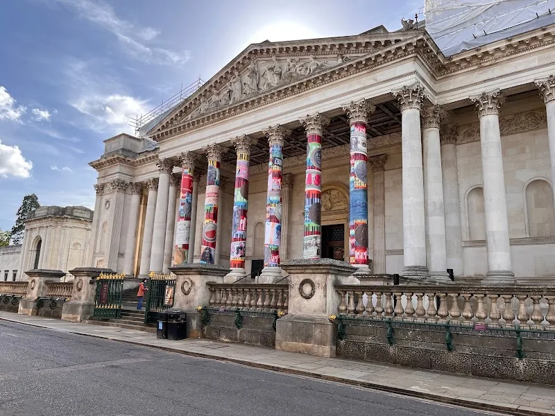
Fitzwilliam Museum is the best anchor for the southern part of a Cambridge city centre map. It works well with Trumpington Street, Pembroke, the Botanic Garden side and the route toward the railway station. Add it when you want culture and indoor time, not just college exteriors.
Station, cycling streets and quieter Cambridge
The railway station is not beside the postcard core, so plan the arrival walk or bus link before fixing your first stop. Cambridge is famous for cycling, but first-time visitors usually do better with a walking loop through the centre and a bike only if they want to reach wider green spaces.
Suggested Cambridge Routes from the Map
Classic half day: station or bus arrival, King's Parade, Market Square, Senate House, central college lanes, The Backs and a short River Cam viewpoint.
Full day route: King's College area, River Cam or punting, Fitzwilliam Museum, Botanic Garden side and a slower food stop around Market Square or Mill Road.
Rain-friendly route: keep Fitzwilliam Museum, Kettle's Yard or indoor college visits close to the map, then use dry gaps for King's Parade and The Backs.
Oxford and Cambridge pair: if you are comparing both university cities, use the Cambridge map for river and college lanes, then our Oxford map for Radcliffe Camera, Bodleian Library and Christ Church.
Where to Stay in Cambridge for Easy Map Routes
For a first visit, compare Cambridge city centre, near the railway station, Mill Road and the River Cam or Jesus Green side. City centre is best for walking, the station area is practical for arrivals, Mill Road works well for food and local energy, and the river side feels calmer if you want green space.
Find accommodation in Cambridge
Plan activities, insurance and flights for Cambridge
Once the map route is clear, the next practical step is checking what to book around it: guided activities, travel insurance and flight options if you are coming from abroad.
Use the activity widget below to compare current tours and tickets for Cambridge. For the travel side, you can also review insurance with IATI and compare flights before fixing dates.
Check travel insurance with IATI Compare flights for Cambridge
Cambridge Map Planning Checklist
Best first anchor: King's College Chapel and Market Square.
Best route layer: colleges first, then River Cam, museums and station logistics.
Best time saver: decide whether punting is part of the route before you plan the rest of the day.
Best mistake to avoid: treating the station, The Backs and Fitzwilliam Museum as if they sit on one straight line.
Frequently Asked Questions about the Cambridge Tourist Map
What should be on a Cambridge tourist map?
A useful Cambridge tourist map should include King's College, Market Square, Senate House, Trinity Street, The Backs, River Cam, Fitzwilliam Museum, Botanic Garden, the railway station, cycling areas and central stay zones.
Is Cambridge easy to visit on foot?
Yes. The historic centre is very walkable, and many major sights sit close together. A map is still useful because the station, river, colleges and museums pull the route in different directions.
Where should a Cambridge walking route start?
If you arrive by train, start by deciding how you will reach the centre. Once there, King's College and Market Square make the clearest first anchors for a compact walking route.
Do you need to go punting in Cambridge?
No, but punting is one of the easiest ways to understand the River Cam and The Backs. If you skip it, still add at least one riverside viewpoint to the map route.