
Manchester Tourist Map: City Centre, Trams, Canals and Attractions
We are Ana and Kevin, and Manchester works best when the map is split between the compact city centre and the places that need a tram or a longer walk. This Manchester tourist map helps you connect Albert Square, Northern Quarter, Deansgate, Castlefield, museums, football areas, Salford Quays and practical stay bases.
Disclosure: this article contains affiliate links. We may earn a commission if you book accommodation through them, at no extra cost to you.
If you are searching for a Manchester visitor map, tourist map of Manchester, Manchester city centre map or Manchester attractions map, start with the walking core first. The centre is manageable, but football grounds, Salford Quays and airport transfers need transport planning. For wider UK planning, compare this page with our England tourist map, London tourist map, York tourist map, Scotland tourist map and Brighton tourist map.
Interactive Tourist Map of Manchester
Use the map to group the city centre, Northern Quarter, Ancoats, Castlefield, Deansgate, museum areas, football stadium zones, Salford Quays and Metrolink routes. Manchester is easy to explore, but the best day depends on how much walking, music, food, museums or football you want.
Load the Manchester map to group the city centre, Northern Quarter, Castlefield, museums, football areas, trams and stay bases.
Open the Manchester tourist map in Google MapsBest Areas to Read on the Manchester Map
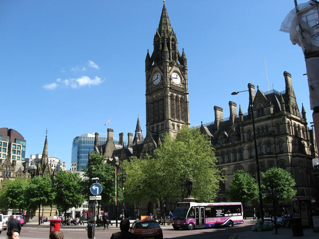
Albert Square, city centre and Deansgate
Albert Square, Manchester Town Hall, St Peter's Square, Deansgate and the shopping streets make the easiest central orientation route. This is the section we would use first before branching toward Northern Quarter or Castlefield.
Northern Quarter, Ancoats and food streets
Northern Quarter and Ancoats are close enough to add after the city centre, but they deserve time if you care about cafes, independent shops, music venues and food. Put them into one walking block instead of treating them as a quick detour.
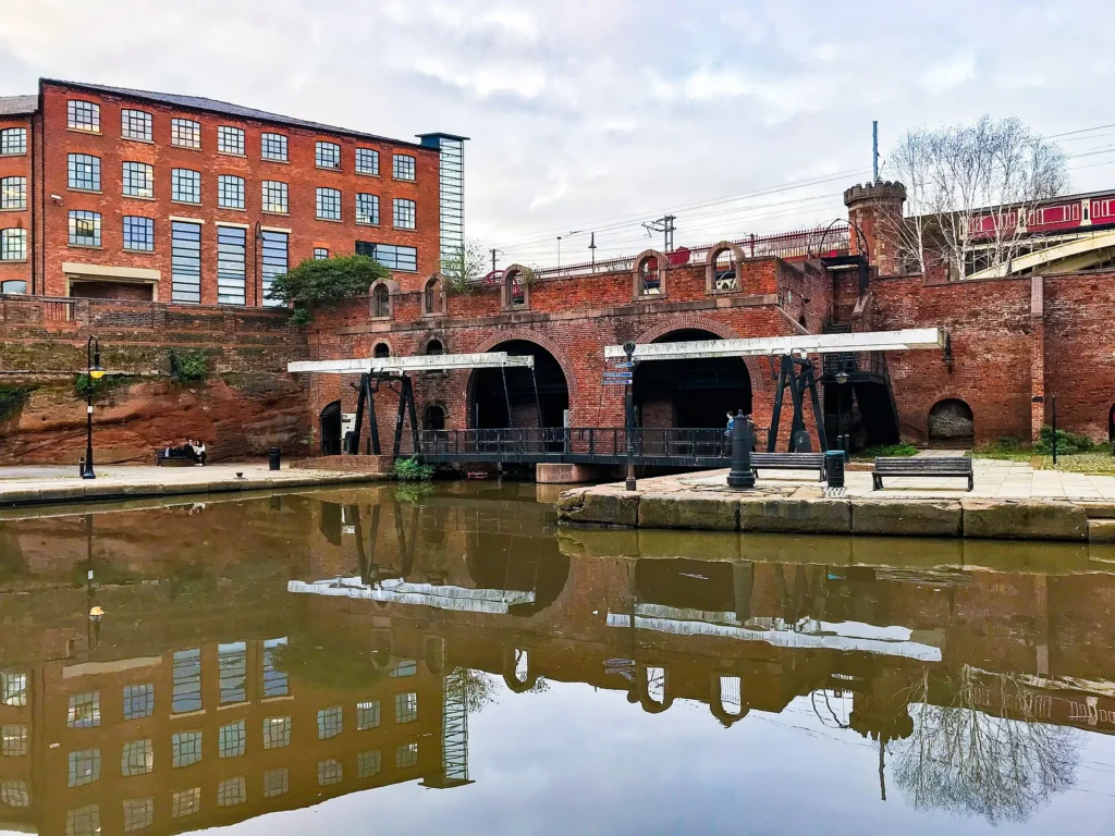
Castlefield, canals and warehouse Manchester
Castlefield gives the map a different texture: canals, bridges, old warehouses and a calmer route near Deansgate. It is a useful place to slow the day down after central streets and shopping areas.
Museums, football areas and Salford Quays
The Science and Industry Museum, National Football Museum, Old Trafford, Etihad area and Salford Quays all change the route. Some are central, others need Metrolink or a planned transfer, so decide whether football or museums are the main priority for that day.
Suggested Manchester Routes from the Map
Classic city centre walk: Albert Square, St Peter's Square, Deansgate, shopping streets, Cathedral area and Northern Quarter.
Canals and culture route: Deansgate, Castlefield, Science and Industry Museum and a slower canal-side section.
Food and music route: Northern Quarter, Ancoats and evening venues, with a compact hotel base to avoid late transfers.
Football or Quays day: use Metrolink for Old Trafford, Etihad or Salford Quays, then keep the rest of the route lighter.
Where to Stay in Manchester for Easy Map Routes
For a first visit, compare city centre, Northern Quarter, Deansgate/Castlefield, Piccadilly and Salford Quays. City centre is easiest for sightseeing, Northern Quarter is stronger for food and evenings, Piccadilly helps with rail arrivals, and Salford Quays can work if your plan is football, events or waterfront stays.
Find accommodation in Manchester
Manchester Map Planning Checklist
Best first anchor: Albert Square, St Peter's Square and Deansgate for city centre orientation.
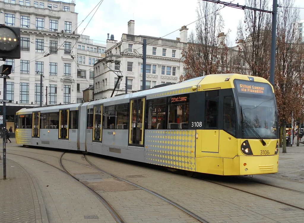
Best transport layer: Metrolink when the route stretches to stadiums, Salford Quays or outer districts.
Best route decision: choose city centre plus one theme: canals, food, museums, football or music.
Best mistake to avoid: planning football areas as if they were all central walking stops.
Frequently Asked Questions about the Manchester Tourist Map
What should be on a Manchester tourist map?
A useful Manchester tourist map should include Albert Square, Deansgate, Northern Quarter, Ancoats, Castlefield, museums, Piccadilly, Salford Quays, football areas and Metrolink stops.
Is Manchester easy to visit on foot?
Yes. The city centre, Northern Quarter, Deansgate and Castlefield are walkable. Use Metrolink when you add stadiums, Salford Quays or longer transfers.
Where should you stay in Manchester for sightseeing?
City centre, Northern Quarter, Deansgate/Castlefield and Piccadilly are the most practical bases for a first visit. Salford Quays is useful for events, football and waterfront stays.
Do you need a Manchester tram map?
Yes if your plan includes football grounds, Salford Quays, airport-style transfers or outer districts. For the compact centre, walking is often simpler.