Brighton Tourist Map: Attractions, Beach and Walking Routes
We are Ana and Kevin, and Brighton is exactly the kind of city where a map saves time. The beach, Palace Pier, Royal Pavilion, The Lanes, North Laine, i360, Hove and the seafront all feel close, but the best day depends on how you group them. This tourist map of Brighton helps you plan the city as a walkable seaside route instead of a scattered list of attractions.
Disclosure: this article contains affiliate links. We may earn a commission if you book accommodation or activities through them, at no extra cost to you.
If you are searching for a Brighton tourist attractions map, Brighton beach map UK or tourist map of Brighton, start with the seafront and the historic center. For a wider England itinerary, compare this page with our tourist map of England, tourist map of London, tourist map of Bournemouth and tourist map of Bath.
Interactive Tourist Map of Brighton
The interactive map is useful for grouping the classic Brighton route: Palace Pier, the beach, Royal Pavilion, The Lanes, North Laine, i360 and Hove. We would use it before booking accommodation, because staying close to the seafront, station or North Laine changes how easy the day feels.
Use this interactive tourist map of Brighton to explore the main attractions, routes, viewpoints and practical planning areas.
Open the Brighton tourist map in Google MapsBest Areas to Read on the Brighton Map
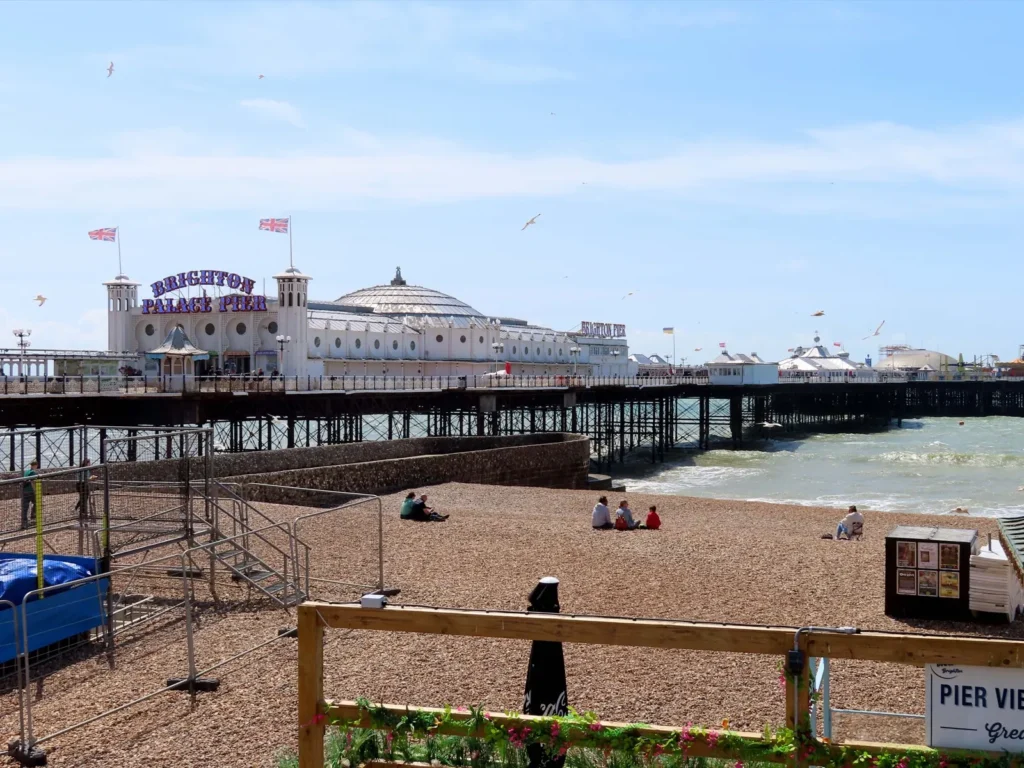
Brighton Palace Pier and the seafront
The pier and seafront are the easiest first anchor on the map. This is where Brighton feels most immediate: beach, arcades, sea views, fish and chips, beach bars and long promenade walks. If your search is mainly for a Brighton beach map UK, start here and then decide whether to walk west toward i360 and Hove or inland toward the Royal Pavilion.
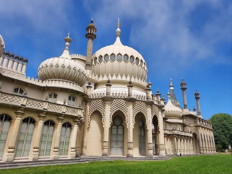
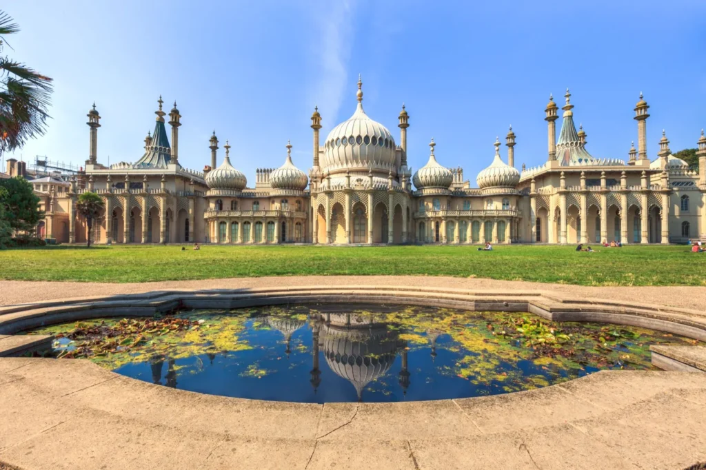
Royal Pavilion and the cultural center
The Royal Pavilion sits just inland from the beach and works well as the bridge between the seafront and the shopping lanes. It is a strong first-time stop because it gives the route a clear landmark, especially if the weather turns and you need an indoor option.
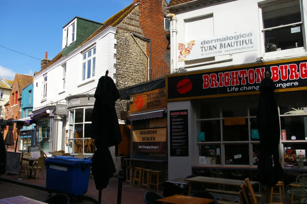
The Lanes and North Laine
The Lanes are compact, historic and good for independent shops, cafes and small streets. North Laine is more colorful and creative, with vintage shops, food stops and street energy. We would not rush this part. It is the section of the map where wandering is part of the plan.
British Airways i360 and the western seafront
The i360 and western seafront are useful if you want a clearer view of Brighton's coastline. This area also helps connect the city center with Hove, so it works well for a longer walk after the pier and beach.
Hove, Kemptown and Brighton Marina
Hove gives the map a calmer finish with wide seafront walks and elegant streets. Kemptown and Brighton Marina sit to the east and make more sense if you have extra time or want a less central base. Put them in a separate block rather than squeezing them between the pier and The Lanes.
Suggested Brighton Walking Routes
Classic half-day route: Brighton Station, North Laine, Royal Pavilion, The Lanes, Palace Pier and the beach.
Full-day seafront route: Palace Pier, beach, i360, Hove lawns, return through The Lanes and North Laine for food or shopping.
Rain backup route: Royal Pavilion, Brighton Museum, The Lanes, covered cafes and a shorter seafront walk when the weather opens.
Slow weekend route: one day for central Brighton and one day for Hove, Kemptown, the marina or a South Downs detour.
Brighton Map Planning Checklist
Best first anchor: Palace Pier and the seafront.
Best short route: Station, North Laine, Royal Pavilion, The Lanes and the beach.
Best beach extension: walk west toward i360 and Hove if the weather is good.
Best timing note: summer weekends are busy, so book central stays early and keep restaurant plans flexible.
Where to Stay in Brighton for Easy Map Routes
For a short visit, we would compare stays around the seafront, North Laine, The Lanes, Brighton Station and Hove. The seafront is best for beach access, North Laine is practical for food and shops, the station helps with London day trips and Hove is calmer for a slower weekend.
Find accommodation in Brighton
Practical Brighton Map Tips
Plan around the wind and weather. Brighton is coastal, so a sunny map route can feel different when the wind picks up. Keep an indoor stop near your route.
Use walking first. The core route from the station to North Laine, Royal Pavilion, The Lanes and the pier is very walkable. Save buses or taxis for Hove, the marina or tired legs.
Summer is busy. June to August bring the strongest beach demand. Book central accommodation early if you want to stay close to the map route.
Do not confuse The Lanes and North Laine. They are close, but they feel different. The Lanes are more historic and compact; North Laine is more alternative and independent.
Frequently Asked Questions about the Brighton Tourist Map
What is the best way to use this tourist map of Brighton?
Use it to build a walk from Brighton Station through North Laine, Royal Pavilion, The Lanes, Palace Pier and the beach. Add Hove or the marina only if you have extra time.
What attractions should be on a Brighton tourist attractions map?
Palace Pier, Brighton Beach, Royal Pavilion, The Lanes, North Laine, British Airways i360, Hove and the marina are the main places to check first.
Is Brighton beach easy to find on the map?
Yes. Brighton Beach runs along the seafront below the city center. The pier is the easiest landmark, and from there you can walk west toward i360 and Hove or east toward Kemptown.
Where should I stay in Brighton for sightseeing?
The seafront, The Lanes, North Laine, Brighton Station and Hove are the most practical areas. Choose the seafront for beach access or the station/North Laine area for easy arrivals and food.