
Hong Kong Tourist Map: MTR, Areas, Islands and Attractions
We are Ana and Kevin, and Hong Kong is one of those cities where the map should be read in layers: MTR lines, harbour crossings, walkable districts, viewpoints, islands and day-trip zones. This Hong Kong tourist map helps you group the main sights without wasting the day crossing the harbour too many times.
Disclosure: this article contains affiliate links. We may earn a commission if you book accommodation, activities, insurance or flights through them, at no extra cost to you.
If you are searching for a Hong Kong attraction map, Hong Kong tourist attractions map, HK tourist map or Hong Kong map tourist spots, start with the MTR and the harbour. Hong Kong Island, Kowloon and Lantau all make sense, but not always on the same half day. For wider Asia planning, compare this guide with our China tourist map, Vietnam tourist map and Thailand tourist map.
Interactive Tourist Map of Hong Kong
Use the map to separate the central harbour route, Hong Kong Island, Kowloon, Lantau and island options. The city is compact on paper, but queues, ferries, hills and MTR transfers can change how much you should plan for one day.
Load the Hong Kong map to group MTR-friendly areas, Victoria Harbour, Kowloon, Hong Kong Island, Lantau and practical stay bases.
Open the Hong Kong tourist map in Google MapsBest Areas to Read on the Hong Kong Map
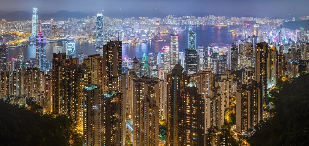
Victoria Harbour, Central and Hong Kong Island
Victoria Harbour is the first reference point because it explains the shape of the city. Central, Admiralty, Wan Chai, Sheung Wan and the Peak side work well as one map layer, especially if you want skyline views, tram access, ferries and evening harbour light.
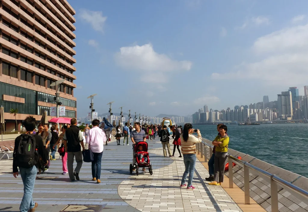
Kowloon, Tsim Sha Tsui and Mong Kok
Kowloon gives the route a different rhythm. Tsim Sha Tsui is strong for the promenade, Star Ferry, museums and harbour views, while Mong Kok and Jordan add markets, food streets and a denser city feel. We would avoid bouncing between Kowloon and Central every few hours; choose a side, then cross once with purpose.
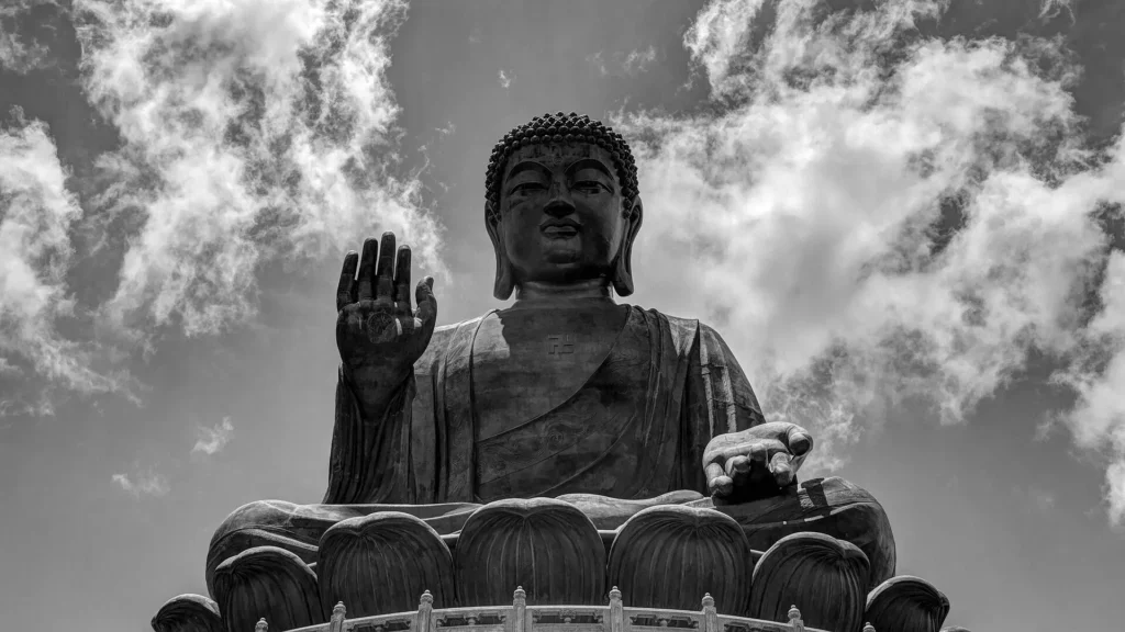
Lantau, Big Buddha and airport-side planning
Lantau needs its own map decision. The Big Buddha, Ngong Ping, airport area and Disneyland side are not just another central stop. Put Lantau on a separate day or connect it with arrival/departure timing if that keeps the route efficient.
Islands, ferries and slower routes
Cheung Chau, Lamma Island and ferry routes are best for a slower day. They are close enough to tempt you into overplanning, but the value is in giving them time: ferry ride, food, waterfront walks and a less vertical version of Hong Kong.
Suggested Hong Kong Routes from the Map
First-time harbour route: Central, Star Ferry, Tsim Sha Tsui Promenade, Avenue of Stars and an evening skyline stop.
Hong Kong Island day: Sheung Wan, Central, Mid-Levels, Victoria Peak and a return by tram or MTR depending on crowds.
Kowloon food and markets: Tsim Sha Tsui, Jordan, Yau Ma Tei and Mong Kok, with short MTR jumps only when your legs ask for it.
Lantau day: Tung Chung, Ngong Ping, Big Buddha and a calmer return plan instead of forcing it between central districts.
Where to Stay in Hong Kong for Easy Map Routes
For a first visit, compare Central/Sheung Wan, Tsim Sha Tsui, Wan Chai/Causeway Bay and Mong Kok/Jordan. Central is practical for business, ferries and the Peak; Tsim Sha Tsui is strong for views; Wan Chai and Causeway Bay work well for transport; Mong Kok and Jordan are useful if you want food, markets and lower prices.
Find accommodation in Hong Kong
Plan activities, insurance and flights for Hong Kong
Once the map route is clear, the next practical step is checking what to book around it: guided activities, travel insurance and flight options if you are coming from abroad.
Use the activity widget below to compare current tours and tickets for Hong Kong. For the travel side, you can also review insurance with IATI and compare flights before fixing dates.
Check travel insurance with IATI Compare flights for Hong Kong
Hong Kong Map Planning Checklist
Best first anchor: Victoria Harbour, because it separates Hong Kong Island and Kowloon clearly.
Best transport layer: the MTR for most city moves, with ferries used when the crossing is part of the experience.
Best route decision: do not mix Lantau with too many central stops unless your flight timing makes it logical.
Best mistake to avoid: treating every attraction as close just because the city looks compact on the map.
Frequently Asked Questions about the Hong Kong Tourist Map
What should be on a Hong Kong tourist map?
A useful Hong Kong tourist map should include Victoria Harbour, Central, the Peak, Tsim Sha Tsui, Mong Kok, Lantau, Big Buddha, ferry piers, MTR-friendly stay areas and island options.
Is Hong Kong easy to visit with the MTR?
Yes. The MTR is the easiest transport layer for most visitor routes, but ferries, hills and queues still matter when planning realistic daily sections.
Where should you stay in Hong Kong for sightseeing?
Central, Sheung Wan, Tsim Sha Tsui, Wan Chai, Causeway Bay, Jordan and Mong Kok all work. Choose based on whether you prefer harbour views, nightlife, markets, budget or airport access.
How many days do you need for Hong Kong?
Three days can cover the main city map, but four or five days make it easier to add Lantau, islands, markets and slower food-focused routes.