Welcome to Jerte Valley, Extremadura!
Are you ready to experience the spring spectacle of a million cherry trees blooming in unison in Jerte Valley? This phenomenon, known as 'La Fiesta del Cerezo en Flor', turns the valley in Extremadura into a mesmerizing white ocean. But that's not all! You'll also discover sprawling vineyards, ancient towns rich in history, and nature trails that will take your breath away. From hiking the lush Garganta de los Infiernos, delving into the medieval appeal of Plasencia, to tasting the unique Picota cherries, Jerte Valley offers experiences that will linger in your memory.
Disclosure: this article contains affiliate links. We may earn a commission if you book accommodation, activities, insurance or flights through them, at no extra cost to you.
Discover Jerte Valley with Our Tourist Map
Our specially curated Tourist Map of Jerte Valley, Extremadura, is your visual companion to this diverse region. It guides you to various attractions such as museums, monuments, historic towns, hiking trails, and cherry farms, giving you an all-encompassing view of the valley. The map is packed with useful information like visit time, budget suggestions, and traveler recommendations, making it a handy tool when planning your visit. Ready to embark on your Jerte Valley exploration? Get your mobile devices loaded with our interactive map and wander at your own pace.
Use this interactive tourist map of Jerte Valley, Extremadura to explore the main attractions, routes, viewpoints and practical planning areas.
Open the Jerte Valley, Extremadura tourist map in Google MapsHow to Make the Most of the Map to Visit Jerte Valley, Extremadura
Our interactive Tourist Map of Jerte Valley, Extremadura, is a powerful tool designed to enhance your travel experience. It allows you to visualize all nearby points of interest, providing a bird's eye view of the entire destination. The map is organized into distinct layers, each representing a category of attractions such as museums, monuments, historical towns, hiking trails, or cherry farms. With the help of this map, if you have just visited the Monastery of Yuste, for example, you just need to open the map on your mobile and you'll see all the nearby points of interest to continue your tour.
Plan your travel efficiently with the map's layering feature. If you are in the north of Jerte Valley, you can organize the points appearing on the map in route layers and calculate the time from one point to another. This way you can plan better thanks to the estimated visit times provided. This feature not only helps you manage your time but also lets you experience the cultural and geographical diversity of Jerte Valley seamlessly. If you are interested in further exploring Spain, you might also find the tourist map of La Rioja useful.
Experience the Wonder of Jerte Valley, Extremadura
When you visit Jerte Valley, you're in for more than just sightseeing; you'll be stepping into a rich tapestry of history, culture, and natural beauty. From the medieval charm of Plasencia to the rugged beauty of the Garganta de los Infiernos Natural Reserve, each attraction tells a unique story about the valley's past and present. Here are some iconic places and experiences you must not miss while exploring Jerte Valley.
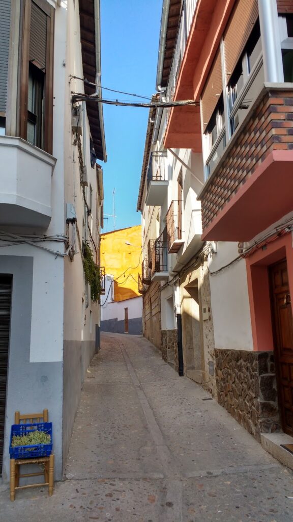
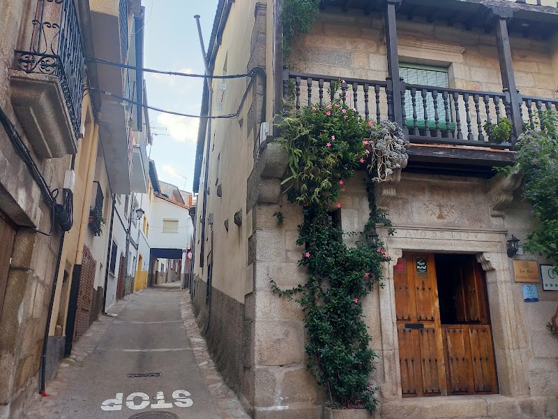
Historical Towns: Plasencia and Cabezuela del Valle
Plasencia, with its grand cathedral, ancient city walls, and bustling Plaza Mayor, offers a fascinating glimpse into the region's past. Meanwhile, Cabezuela del Valle, nestled amidst lush greenery, is a testament to the region's rural heritage. Its narrow, cobbled streets and traditional houses will transport you to a bygone era. The best time to visit these towns is in the morning or late afternoon, when the golden sunlight enhances their timeless beauty.
The Cherry Blossom Festival: 'La Fiesta del Cerezo en Flor'
Every spring, Jerte Valley transforms into a sea of white as over a million cherry trees bloom together. This spectacular event, known as 'La Fiesta del Cerezo en Flor', is celebrated with traditional music, dances, and gastronomic feasts. The best time to witness this phenomenon is between the last week of March and the first week of April, depending on the weather. Local tip: Make sure to try the unique Picota cherries during your visit!
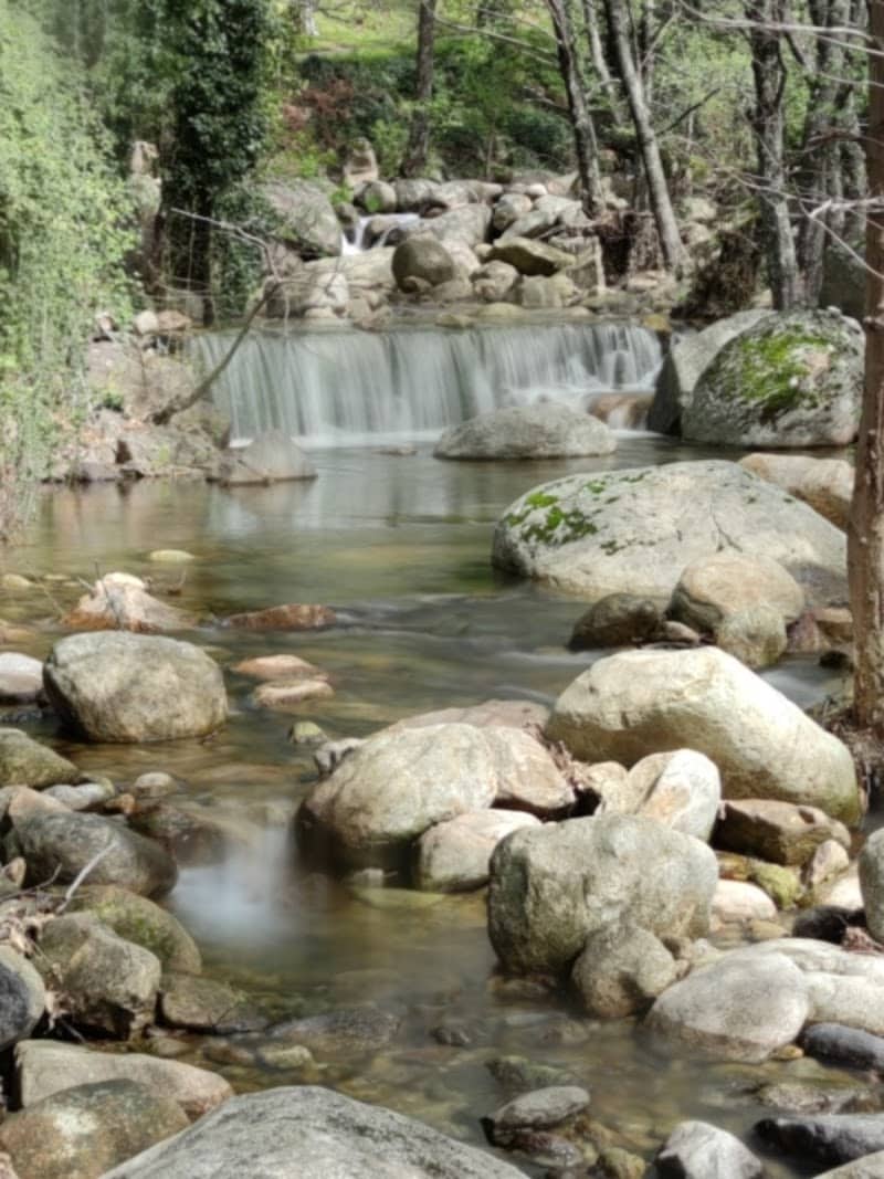
Outdoor Adventures: Garganta de los Infiernos Natural Reserve
For nature lovers and adventure enthusiasts, the Garganta de los Infiernos Natural Reserve is a paradise. Its verdant landscapes, cascading waterfalls, and hiking trails offer countless opportunities for exploration and adventure. The reserve is open year-round, but the best time to visit is in the spring, when the cherry blossom is in full bloom, or in the fall, when the forest is aflame with autumn colors. For more outdoor adventures in Spain, check out our tourist map of Valencian Community.
These are just a few highlights of Jerte Valley, Extremadura. To discover more, use our interactive Tourist Map and embark on an unforgettable journey through this hidden gem of Spain.
Find accommodation in Jerte Valley, Extremadura
Plan activities, insurance and flights for Jerte Valley, Extremadura
Once the map route is clear, the next practical step is checking what to book around it: guided activities, travel insurance and flight options if you are coming from abroad.
Use the activity widget below to compare current tours and tickets for Jerte Valley, Extremadura. For the travel side, you can also review insurance with IATI and compare flights before fixing dates.
Check travel insurance with IATI Compare flights for Jerte Valley, Extremadura
Frequently Asked Questions about Jerte Valley, Extremadura
What is the best way to use this Jerte Valley, Extremadura tourist map?
Use the map to group nearby attractions before choosing your route. This makes it easier to plan realistic days, compare areas and avoid unnecessary backtracking.
Where should I stay when visiting Jerte Valley, Extremadura?
Choose accommodation close to the places you will visit most, or stay near a reliable transport connection if your itinerary covers several areas. A central base usually works best for short trips.
How much time should I plan for Jerte Valley, Extremadura?
A short visit can cover the main highlights, but adding extra time gives you space for viewpoints, museums, food stops, walks and local neighborhoods without rushing.