Anchorage Tourist Map: Downtown, Trails and Day Routes
Use downtown Anchorage as the orientation hub, then choose either the connected urban-trail network or one Chugach-side outing for the day. These layers need different transport plans: central streets and the west-side trail are relatively compact, while hillside and mountain stops should not be treated as a casual extension of a downtown walk.
Disclosure: this article contains affiliate links. We may earn a commission if you book accommodation, activities, insurance or flights through them, at no extra cost to you.
This page owns Anchorage city orientation, urban trails and local day-route decisions. For the wider country layer, use our United States tourist map. Keep the Juneau tourist map and Denali National Park tourist map as separate destinations rather than folding all of Alaska into one route.
Interactive Anchorage Tourist Map
Start with the official Anchorage visitor maps, which separate downtown, city, trail, public-art and wider regional layers. Use our interactive map to locate the centre, waterfront trail access, south Anchorage connections and the Chugach-facing edge of the city.
Use this interactive tourist map of Anchorage Tourist Map: Downtown, Trails and Day Routes to explore the main attractions, routes, viewpoints and practical planning areas.
Open the Anchorage Tourist Map: Downtown, Trails and Day Routes tourist map in Google MapsChoose the Right Anchorage Map Layer
| Zone | Best for | Movement | Best day shape |
|---|---|---|---|
| Downtown | First orientation, museums and central services | Walkable core with onward connections | Arrival day or compact city day |
| West-side waterfront | Coastal trail and lagoon viewpoints | Walk or cycle on the connected trail | Half-day linear route |
| South Anchorage | Trail junctions and broader local parks | Cycle, transit or planned vehicle access | Dedicated urban-trail day |
| Hillside and Chugach side | Mountain context and trailhead outings | Separate transport and current-condition check | One focused outing |
Downtown as the Orientation Hub
Downtown is the simplest place to read the city grid before deciding how far to extend the day. Keep the first route compact: understand the central streets, identify the correct trail access and confirm how you will return before adding a mountain-side stop.

A central base reduces unnecessary crossings, but it does not make every Anchorage attraction walkable. The useful decision is whether the day is primarily urban, trail-based or mountain-facing.
Tony Knowles Coastal Trail and the Urban Network
The waterfront trail creates a clear west-side line from the central area. It works better as an out-and-back or point-to-point route than as a collection of disconnected stops. Decide the turnaround point in advance and keep enough time for the return.
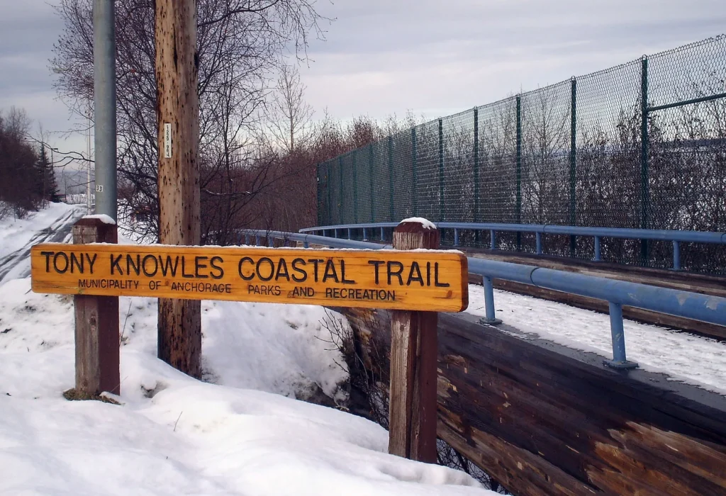
The Municipality of Anchorage describes a wider municipal trail wayfinding system connecting the Tony Knowles Coastal, Campbell Creek, Chester Creek, Fish Creek and Ship Creek corridors. Check that current information before relying on a connection, and follow signs on the ground.
South Anchorage and Chugach-Side Outings
South Anchorage and the hillside need a broader map scale. A trailhead that looks close to downtown on a regional map may still require a deliberate transport plan. Choose one outdoor objective, verify current access and conditions, and do not pair it with a long waterfront route unless the timing genuinely works.

The mountains define Anchorage visually, but they are not part of the compact city grid. Treat this as a distinct route layer and avoid language or plans that assume wildlife sightings, easy terrain or fixed conditions.
Three Practical Anchorage Routes
Compact city route: downtown orientation, central cultural stops and a short waterfront section.
Urban-trail route: downtown or a chosen trail access, one connected trail corridor and a planned turnaround.
Mountain-side route: one verified hillside or Chugach-facing objective, with transport and conditions checked before departure.
Where to Stay in Anchorage
Downtown is the clearest base for a first visit and for travellers prioritising central orientation. A base farther south can make sense when the itinerary is dominated by local trail connections, while a hillside location trades central convenience for quicker access to the eastern edge. Choose the dominant route first, then compare accommodation.
Find accommodation in Anchorage
Planning Checks Before You Go
- Use a city map and a trail map; neither replaces the other.
- Check municipal trail information and on-site wayfinding before relying on a connection.
- Keep mountain access, weather and terrain language current rather than using fixed promises.
- Build the day around one route family to avoid repeated cross-city travel.
Frequently Asked Questions
What should an Anchorage tourist map include?
It should separate downtown, the west-side waterfront trail, south Anchorage trail connections and the hillside or Chugach-facing edge. A single attraction map does not show the transport difference between those zones.
Can Anchorage be explored without a car?
A central city and urban-trail plan can be built without treating every outing as a drive. Mountain-side and remote-feeling stops need an individual access check; do not assume the entire destination works as one car-free network.
Is the Tony Knowles Coastal Trail a full-day route?
It can form either a shorter waterfront outing or a longer trail day. The right choice depends on the selected access point, turnaround and current trail information.
Plan activities, insurance and flights for Anchorage
Once the map route is clear, the next practical step is checking what to book around it: guided activities, travel insurance and flight options if you are coming from abroad.
Use the activity widget below to compare current tours and tickets for Anchorage. For the travel side, you can also review insurance with IATI and compare flights before fixing dates.
Check travel insurance with IATI Compare flights for Anchorage