Zion National Park Map: Canyon, Shuttle, Trails and Scenic Drives
We are Ana and Kevin, and Zion is a park where the map directly changes your day. The key is not only where Zion Canyon sits in Utah, but how the shuttle corridor, trailheads, scenic drives, parking and nearby Springdale work together. This Zion National Park map helps you choose a route before you arrive at a crowded trailhead.
Disclosure: this article contains affiliate links. We may earn a commission if you book accommodation, activities, insurance or flights through them, at no extra cost to you.
If you are searching for map of Zion National Park, map Zion Canyon, Zion shuttle map or Zion National Park Utah map, start with Zion Canyon first. For a wider Utah parks route, compare this page with our Arches National Park tourist map, Canyonlands National Park tourist map and Grand Canyon tourist map.
Interactive Zion National Park Map
Use the map to group the visitor center, Zion Canyon shuttle stops, trailheads, scenic drives, Springdale and nearby bases. Zion looks simple on a map, but shuttle season, permits and parking can decide what is realistic.
Load the Zion map to plan Zion Canyon, shuttle stops, trailheads, scenic drives, Springdale and nearby Utah park routes.
Open the Zion National Park map in Google MapsHow to Read Zion Canyon on the Map
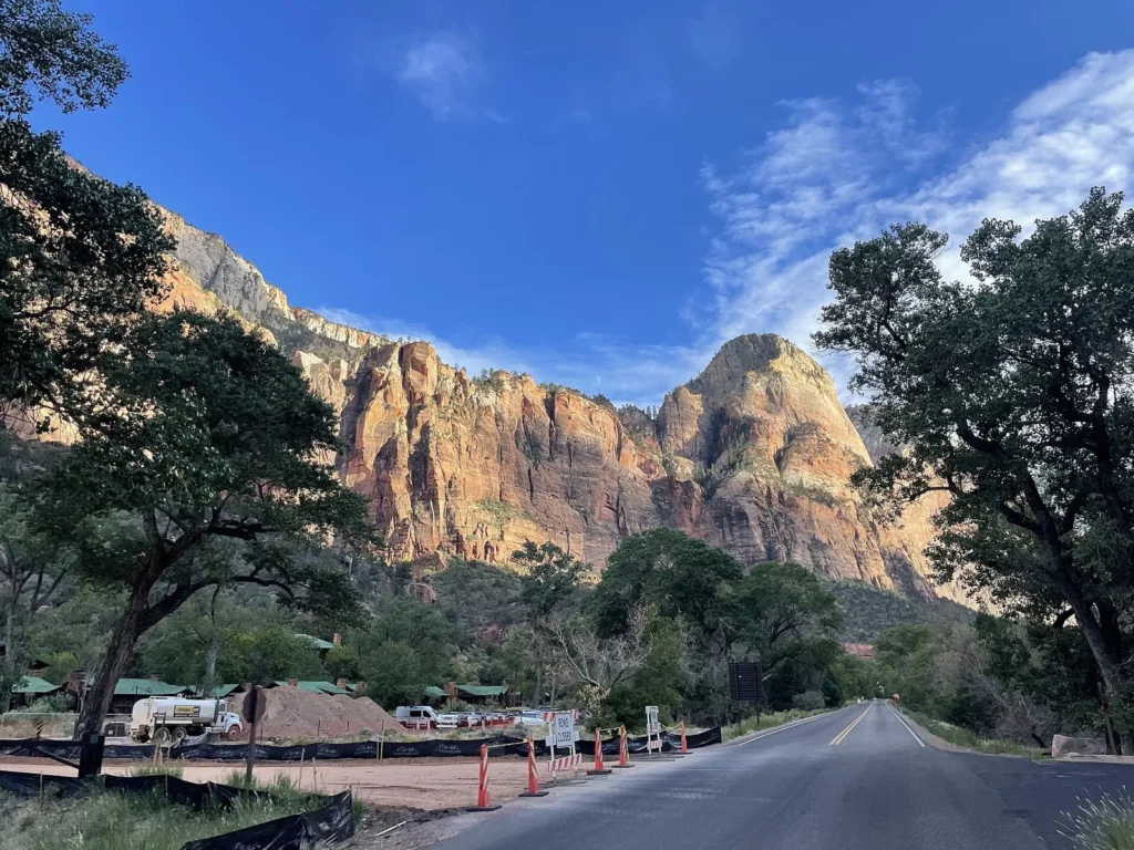
Visitor center, Springdale and shuttle corridor
The visitor center and Springdale are the practical start of most Zion plans. During shuttle season, the canyon route is not a normal drive-in sightseeing road, so use the map to understand shuttle stops before choosing hikes.
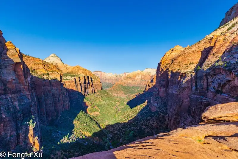
Easy walks and viewpoints
Riverside Walk, Lower Emerald Pools, Pa'rus Trail and canyon viewpoints are good options if you want Zion scenery without committing to a hard hike. Put them in the same day as shuttle planning and heat management.
Serious hikes and permit-aware planning
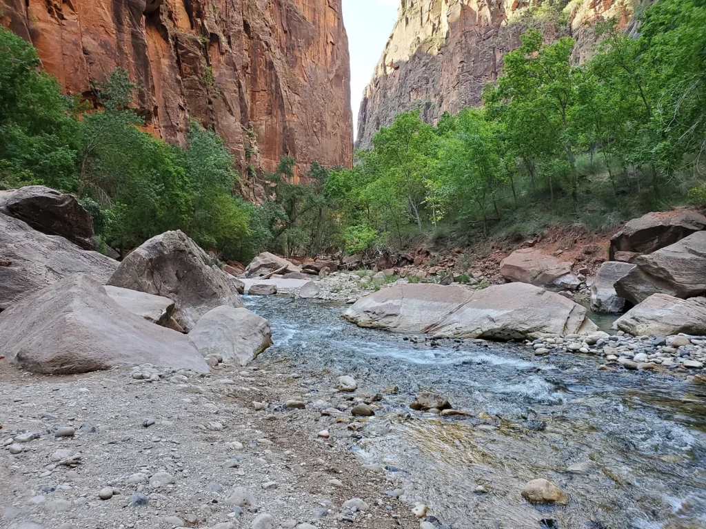
Angel's Landing, The Narrows and longer routes need more than a pin on the map. Check permits, water levels, flash flood risk, heat and your own pace. A good Zion map should help you say no to the wrong hike on the wrong day.
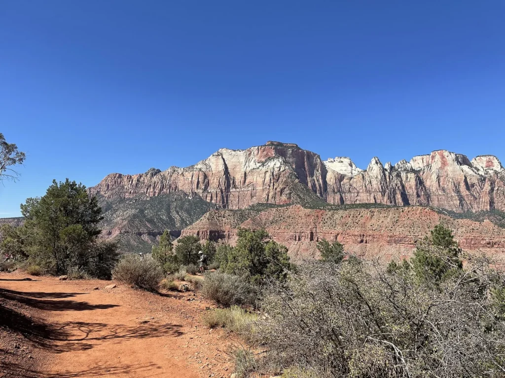
Watchman, scenic drives and nearby bases
The Watchman area, Canyon Junction, the Zion-Mount Carmel Highway and Springdale all help you plan the park around arrival and departure. This is especially useful if Zion is part of a larger Utah road trip.
Suggested Zion Routes from the Map
First afternoon: visitor center, Pa'rus Trail or Watchman area, sunset viewpoint and Springdale base.
Classic canyon day: early shuttle, Riverside Walk or The Narrows conditions permitting, Emerald Pools and scenic stops on the way back.
Scenic drive day: Zion-Mount Carmel Highway, Canyon Overlook area if appropriate, viewpoints and a slower return to Springdale.
Utah parks route: connect Zion with Bryce Canyon, Grand Canyon, Page or the Mighty Five only after checking drive times and park entry logistics.
Where to Stay near Zion National Park
For map-friendly planning, compare Springdale, inside-park lodging if available, Hurricane, La Verkin and St. George. Springdale is the easiest for shuttle access; outer towns can save money but add driving and parking pressure.
Find accommodation near Zion National Park
Plan activities, insurance and flights for Zion National Park Map
Once the map route is clear, the next practical step is checking what to book around it: guided activities, travel insurance and flight options if you are coming from abroad.
Use the activity widget below to compare current tours and tickets for Zion National Park Map. For the travel side, you can also review insurance with IATI and compare flights before fixing dates.
Check travel insurance with IATI Compare flights for Zion National Park Map
Zion Map Planning Checklist
Best first anchor: Zion Canyon Visitor Center and shuttle stops.
Best planning question: will the shuttle be operating during your visit?
Best trail warning: check permits, heat, water levels and flash flood risk before choosing serious hikes.
Best base decision: choose Springdale for convenience or outer towns for budget, knowing that parking and transfers become part of the route.
Frequently Asked Questions about the Zion National Park Map
What should be on a Zion National Park map?
A useful Zion map should include the visitor center, Zion Canyon shuttle stops, trailheads, scenic drives, Springdale, viewpoints and nearby route connections.
Can you drive through Zion Canyon?
Not always. During shuttle season, private vehicles are restricted on the main Zion Canyon Scenic Drive, so visitors use the park shuttle for many canyon stops.
Where should you stay for Zion National Park?
Springdale is the easiest base for shuttle access. Hurricane, La Verkin and St. George can work if you are driving and want more budget options.
Do you need a separate Zion shuttle map?
Yes. The shuttle route is one of the most important layers of the Zion map because it determines how you reach trailheads and viewpoints in Zion Canyon.